| 06-May-2019 |
| SN | Reference | Jammu Region | Kashmir Region | Ladakh Region |
| 1 | Number of Districts during Maharaja Times | 5 (Jammu, Kathua,Udhampur, Reasi & Mir Pur) | 3 ( Anantnag, Baramulla and Muzaffarabad ) | |
| Number of Tehsils | 17 plus two Jagirs | 10 | ||
| 2. | Number of Jagirs during Maharaja Times | 2 ( Poonch and Chenani ) | Nil | |
| 3. | Area (August 1947) | 32145 +4170 = 36315 sq km or 14010 sq miles 16.27% of the State | 22133 sq km or 8539 sq miles 9.92 % of the State | 164739 sq km or 63554 sq miles 73.8 1% of the State |
| Region wise % of area Aug 1947 | ||||
| Area excluding the areas occupied by Pakistan in 1947 | 26293 sq km | 15948 sq km | 96701 sq km | |
| Area occupied by Pakistan in 1947 | 10017 sq km 27.58% of Jammu region Or 4.5 % of the State | 6185 sq km 27.94% of the Kashmir region or 2.79% of the State | 68038 sq km 41.3 % of the Ladakh Region or 30.65 % of the State | |
| 4. | Population 1941 Census | 2010557 | 1728686 | 311915 |
| 5. | Areas occupied by Pakistan | Mirpur District and small part of Poonch | Muzaffrabad | Gilgit/ Baltistan |
| 6. | Districts Excluding POJK | 4 plus two Jagirs | Just 2+ | |
| Districts Made in J&K after 1947 ( excluding Areas occupied by Pakistan | 6 Jammu, Udhampur, Doda, Kathua, Rajouri, Poonch | 3 Anantnag, Srinagar, Baramulla | Leh | |
| Districts made in 1979 vide government orders | Kept as only 6 | Raised from 3 to 6 by SRO 306 of 6/6/1979 Srinagar, Badgam, Anantnag, Pulwama, Baramulla, Kupwara | 2 Kargil and Leh | |
| Districts as recommended by Wazir Commission (1981) in 1984 | 6 + 3 new = 9 | 6 + 1 new = 7 | 2 | |
| Districts made by Cong PDP G. N Azad Government in 2006/07 | 6 +4 = 10 | 6 +4 =10 | 2 | |
| 7. | Elected MLC in Legislative Council as per Section-50 of J&K Constitution | 14 | 12 | 2 |
| 8. | MLAs in J&K Assembly before 1995 Delimitation as got distributed through unfair delimitations ignoring the ground facts like Section-50 of JK Constitution and Section 4 (2a) of RPA 1957 | 31+1= 32 | 42 | 2 |
| MLAs as per 1995 Delimitation order of K.K Gupta Commission | 37 Section-4(2a) of RPA ignored.. Population, Geographical Compactness, Nature of terrain, Facilities of Communication and like considerations. | 46 Jammu Region has much larger area ( less compactness ), bad terrain, much less road networks and communication facilities as compared to Kashmir Valley | 4 | |
| 9. | MPs (Member Parliament) | 2 | 3 | 1 |
| 10 | Population as per 1981 Census | 2718113 | 3134909 | 134372 |
| Population 2001 Census | 4395912 *Questions have been raised on census figures that were released | 5441341 ( *large increase inspite of migration & terrorism) | ||
| Voters as per 2002 Assembly Elections | *28, 92000 | *25,46000 | ||
| 11. | Area Excluding POJK | 26293 sq km | 15948 sq km | 96701 sq km |
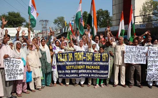
| 12. | Settled displaced people from POJK | Almost all | Nearly nil | |
| 13 | Settled refugees from West Pakistan as accommodated by Maharaja in 1947 | Almost all who came | Nil | |
| 14 | Displaced persons due to terrorism that hit J&K in 1989 | Majority stayed / stays in Jammu Region | No displaced families stayed back in valley | Nil |
| Displaced Persons from Pakistan occupied areas of Indian State of J&K and Refugees from West Pakistan | Majority stayed /stays in Jammu Region | |||
| 15 | Disturbed Line of Control and International Border (LOC & IB ) | Much larger along Jammu Region as compared to Kashmir valley | Smaller part of LOC | Larger part of LOC |
| 16 | Government managed Medical Colleges | 2 | 4 |